
What to check during the viewing
Approach as a resident, visitor, cyclist, delivery driver, bin collector, and emergency service might. Record dropped kerbs, road markings, gates, steps, slopes, surface condition, lighting, turning space, sight lines, charger position, communal controls, and routes for bins and bikes. If a parking space or garage is included, identify it only as stated and measure decision-critical dimensions with permission. Note shared driveways, alleys, private roads, rear access, and maintenance clues. HM Land Registry title plans usually show general boundaries, not exact lines on the ground. Ask the conveyancer to verify title, rights, restrictions, adopted status, and obligations.
Reference example
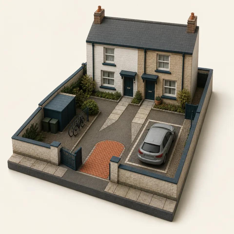
Access and parking
Observed boundaries, shared routes, gates, bay layout, turning space, bins, cycles, and delivery access.
Drive appears shared; one bay is marked; bin route crosses the narrow entrance between boundary walls.
Follow up: Record the arrangement, then ask your conveyancer to verify ownership, rights, restrictions, and allocated parking.
Use a consistent sequence
- Walk every needed route. Trace street to entrance, parking to door, bike to store, bins to collection point, and delivery to threshold. Record steps, narrow gates, steep or uneven surfaces, blind corners, locked sections, heavy doors, and routes passing through communal or neighbouring areas. Do not enter private land without permission.
- Test fit without assuming rights. Where allowed, measure garage opening, bay, turning pinch point, gate, or charger cable route that controls intended use. Record parked vehicles and obstructions as viewing context. Do not park in an unverified space, block access, or infer exclusive ownership from numbering, paving, historic use, or an agent's gesture.
- Record controls and responsibility. Note gates, fobs, permits, bollards, communal lighting, drainage, surfacing, markings, visitor arrangements, and apparent maintenance issues. Ask who operates, repairs, insures, and pays for each element. Photograph no access codes, registrations, post, people, or security details.
- Queue title and highway questions. Ask the conveyancer to check title documents, plans, easements, covenants, parking leases or licences, private-road obligations, adopted-highway position, and restrictions relevant to intended use. Keep physical position, seller statement, plan indication, and legal conclusion as separate records.
What to put in the record
- Sketch arrival, shared, parking, bin, bike, and delivery routes with visible barriers and unverified boundaries clearly labelled.
- Record critical dimensions with endpoints and method, plus vehicle or mobility assumptions that make each dimension relevant.
- Save parking permits, licences, title-plan references, estate rules, charger papers, and maintenance statements by source and date.
- Revisit at a contrasting time if street pressure, school traffic, deliveries, events, or gate operation affects practical use.
Questions for the seller or agent
- Which exact parking, garage, store, driveway, path, road, gate, and charging rights are included, and what document proves each?
- Who maintains and pays for shared or private access, lighting, drainage, surfacing, gates, permits, markings, and snow or vegetation clearance?
- Are there access disputes, restrictions, permit waiting lists, adopted-road questions, planned works, or use limits affecting vehicles, bins, bikes, or deliveries?
What this viewing check cannot establish
Do not infer a legal boundary from a fence, hedge, wall, kerb, plan screenshot, or long-standing use. HM Land Registry explains that title plans show general boundaries in most cases. Exact extent, rights, and obligations may require document review, enquiries, measurements, or specialist advice.
This viewing record does not establish highway adoption, parking entitlement, accessibility compliance, easements, covenants, charger permissions, or liability. Do not test gates by tailgating, copy access credentials, confront users, or obstruct shared space. Route legal questions through the conveyancer and physical-condition questions to suitable professionals.
When to get professional help
Give the conveyancer your route sketch, intended uses, and conflicting statements. Ask them to verify title extent, access and parking rights, restrictions, maintenance and cost obligations, adoption, disputes, and required consents. Where geometry or boundary position is critical, agree suitable survey or specialist scope before relying on marketing plans or buyer measurements.
Continue the property record
Return to the complete UK property viewing checklist or review a connected check:
Use this check in the next decision
Keep the observation attached when you revisit, ask follow-up questions, or compare shortlisted homes:
- Second Viewing Checklist for UK Buyers
- Questions to Ask After a House Viewing
- How to Compare Property Viewings
Apply the same twelve checks with property-specific emphasis:
Primary sources
- HM Land Registry: title plans and general boundaries
- HM Land Registry: finding property information
- GOV.UK: How to buy a home
Last reviewed 9 September 2026. England-focused general information; property, transaction, and professional requirements differ.